Aotearoa (ow-tee-ah-row-ah) is the Māori name for New Zealand. It roughly translates into "the land of the long white cloud." Just outside of Dunedin is a hilly forest area, called the Silverpeaks. One of the peaks is Mt. Cargill, and another one is Flagstaff, which I accomplished this weekend. It was another flat tramp, but only three of us went. The beginning was quite similar to the Mt. Cargill adventure: we walked there and sort-of got lost and asked for directions. But, on the way, there were wonderful views of the city, a cute house with a hobbit-hole-like shed, and weirdly shaped bushes. Eventually, we reached the trailhead and started up on Pineapple Track (the coolest name for a trail).
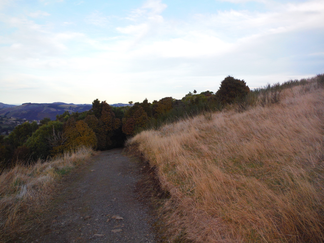
The two terrain types on the Pineapple Track.
Compared to Mt. Cargill, this tramp was much more enjoyable. The Mt. Cargill track was very muddy and rocky, had a steady incline, a very (mostly fern) covered track, and lots of singing birds. The Pineapple Track had a much more varied terrain. The path went from bush and tree covered trails sitting on the edge of the steep mountainside to large, open, straw-colored fields with gorgeous landscape views. There were also more flat (and sometimes downhill) areas. While that may seem good, it meant that other parts of the track were incredibly steep. I found this easier, because I was able to go in bursts. I found myself thinking, "Okay, I can see the end of the incline...just get to the top...you can make it," a lot. This way of trekking up to the peak was much easier to me, and more enjoyable, because it gave me more opportunities to take it easy on flat/downhill areas to recoup and take pictures. I also brought chocolate, again, and water to replenish my energy.
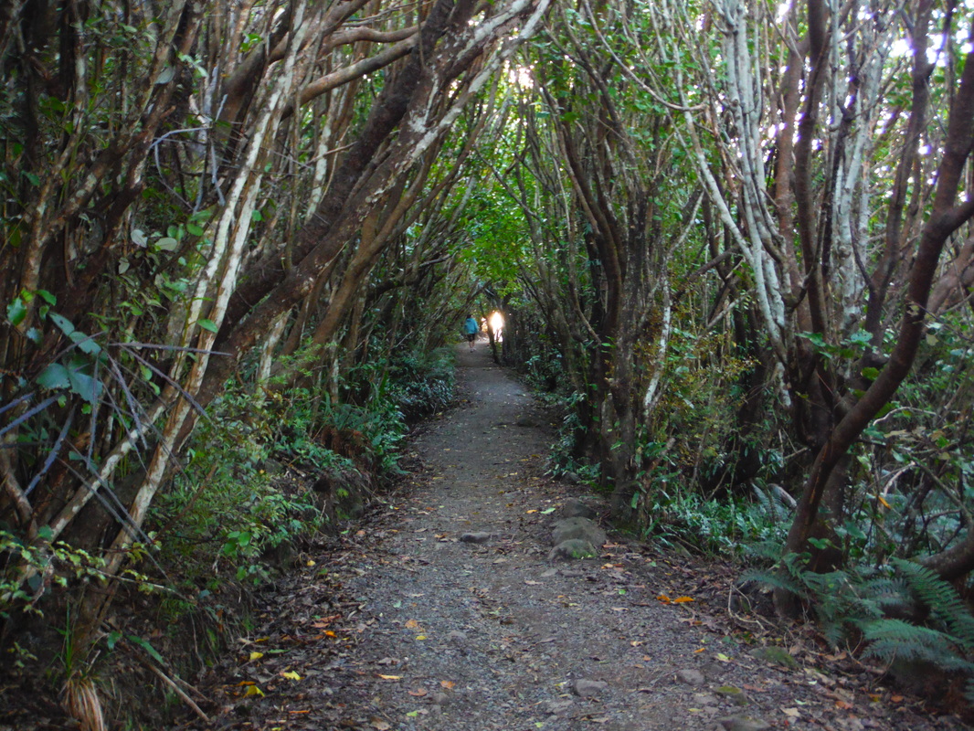
The light at the end of the steep tunnel.
Apparently, runners enjoy going up-and-down each of these peaks...especially while training for an event. They are crazy--in a good way. It is incredible that they can run the entire way up and down. We ran part of the way down...because we started to lose daylight. On the down side, we were all pretty sore the next day, and didn't enjoy the tramp down as much as possible due to the rush. On the bright side, we got to see a beautiful sunset at the peak: across the green forest, straw bush, and behind the snowy mountains in the distance the red sun bled into the sky and colored the clouds with deep blues, purples, reds and pinks. Later on, we also got to see Dunedin light up from the headlights that glowed like fireflies, dim house lights, and warm, organized street lights that would reflect in the ocean.
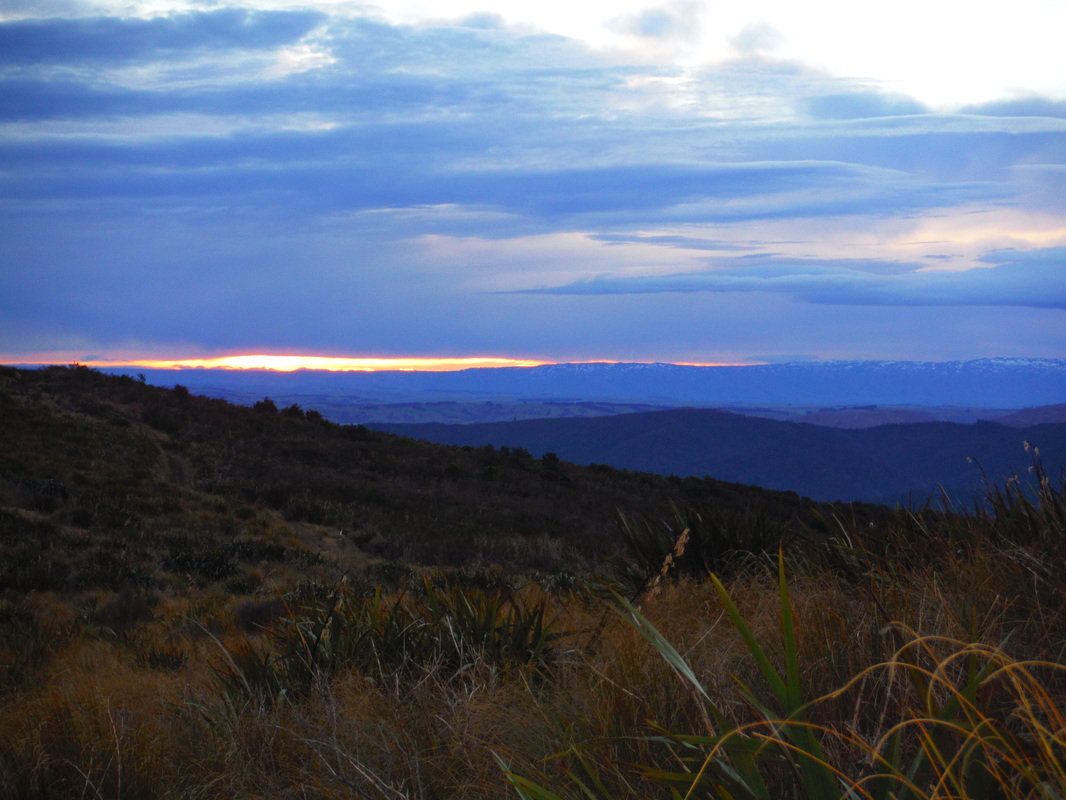
The distant sunset, snowy mountains, and beautiful bush.
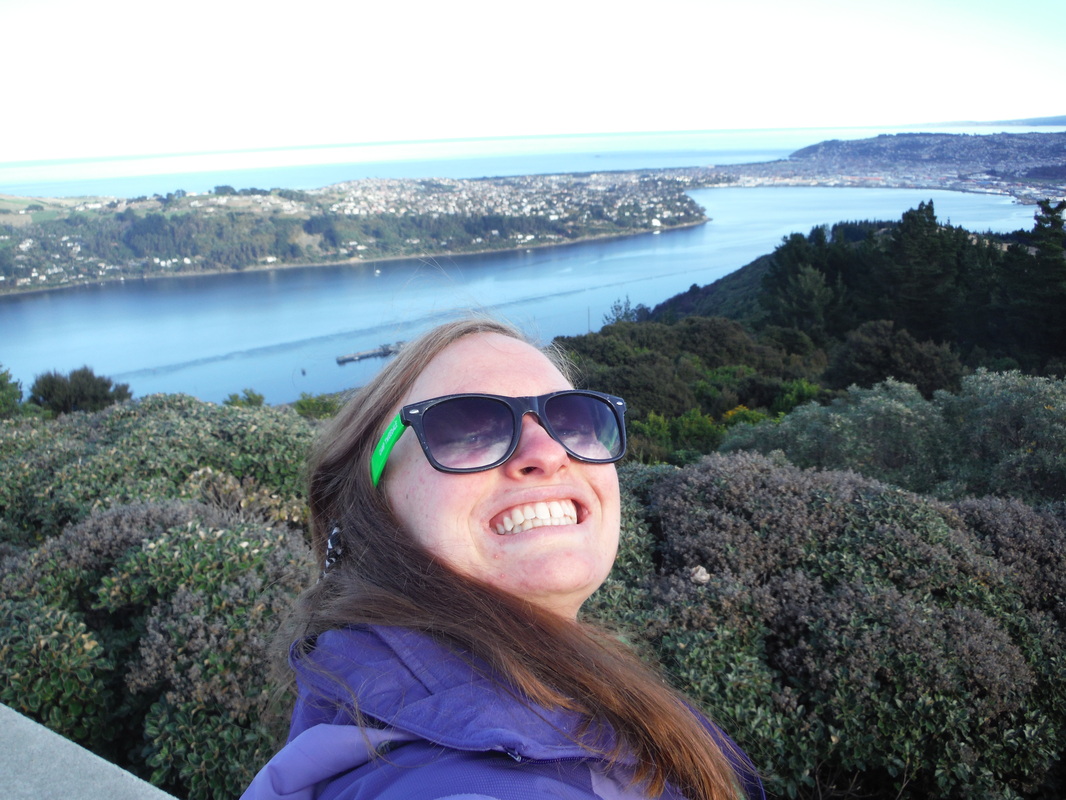
Essentially, this a beautifully scenic tramp. Maybe if I would have gone earlier, I could have heard more singing birds. But then I wouldn't have gotten to see the happiest blue heeler in the world excitedly barking at his biking owners to hurry up. The vantage point at the peak lets you see 360 degrees around you (Mt. Cargill had a radio tower in the way). You can see where the thick forest starts, like a line drawn in the earth, outside of the city. The cold, crisp air purges your lungs of the city haze (the city air is not that bad, but the difference is substantial). And, the workout fills you with a new motivation to accomplish the rest of the day with whatever it may hold.
 RSS Feed